
Houston offers a wide range of visual environments that work well for aerial photography. The city blends dense urban spaces, large parks, waterways, and expanding neighborhoods. This variety makes it ideal for service-based needs such as real estate marketing, infrastructure documentation, and brand visuals. When planned correctly, Houston aerial photography helps show scale, layout, and movement in ways ground photography cannot. Choosing the right location directly affects image clarity and usefulness.
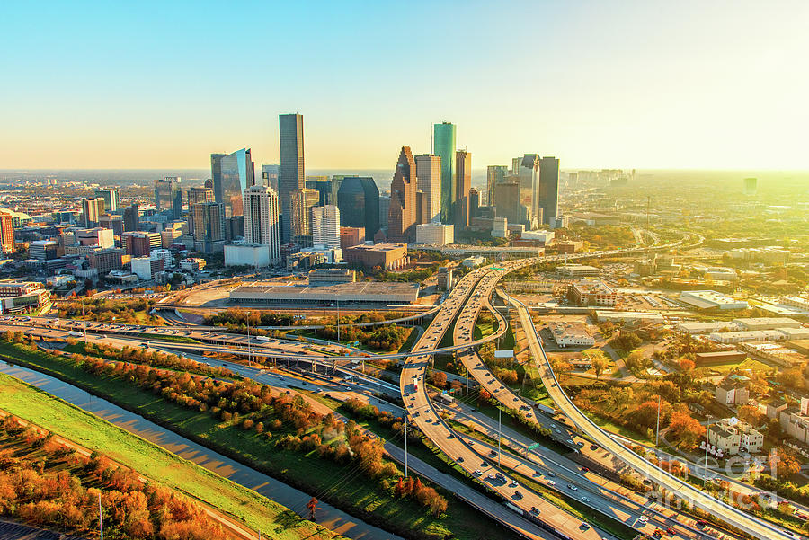
Downtown Houston Skyline
Downtown Houston stands out as a prime location for aerial photography because of its dense urban layout. From above, the area reveals patterns and structure that are not visible at street level.
Key visual elements captured from the air include:
- Tall commercial buildings create a defined skyline
- Intersecting highways and traffic flow patterns
- Compact city blocks that show urban density clearly
These features make downtown shots especially useful for corporate branding, commercial real estate, and city-focused service visuals.
Buffalo Bayou Park
Buffalo Bayou Park provides a strong contrast to Houston’s built-up areas. The curved waterway, walking trails, and tree-lined paths create a smooth visual flow when viewed from above. Aerial angles highlight how green spaces connect with the surrounding skyline. This location works well for lifestyle visuals, public space promotion, and event coverage.
Hermann Park and the Museum District
Hermann Park and the Museum District offer clean layouts that translate well into aerial photography. Open lawns, cultural buildings, and nearby medical centers form organized patterns. The balanced spacing and symmetry make these areas ideal for tourism visuals, institutional projects, and city planning documentation.
Memorial Park
Memorial Park stands out due to its size and natural coverage. From above, the wide trails, open land, and dense tree canopy become more visible. Aerial photography here adds perspective that ground images cannot provide. These visuals often support environmental storytelling, city branding, and large-scale public events.
Houston Ship Channel
The Houston Aerial Photography Ship Channel reflects the city’s industrial strength. From the air, ships, docks, and waterways create strong linear visuals that tell a clear operational story. Aerial photography in this area supports logistics, infrastructure, and industrial service projects. Proper planning remains important due to regulations, but the visual results carry strong informational value.
Rice University Campus
Rice University offers a structured campus layout that works well for aerial framing. Its design allows for clean, organized visuals from above.
Notable aerial features include:
- Symmetrical courtyards and academic buildings
- Clearly defined walkways and green spaces
- Balanced spacing that supports architectural clarity
These elements make the campus suitable for educational marketing, architectural documentation, and institutional visuals.
Residential Developments and Suburbs
Houston’s growing suburbs and planned communities provide valuable aerial photography opportunities. From above, these areas show scale, organization, and connectivity.
Aerial visuals commonly highlight:
- Road networks and neighborhood layouts
- Housing clusters with surrounding green buffers
- Overall planning and land use patterns
For real estate and development services, Houston aerial photography helps clients quickly understand location, access, and growth potential.
Conclusion
Houston offers diverse locations that support a wide range of aerial photography needs. Each area serves a specific purpose, depending on the project goal. Careful location selection and thoughtful planning help ensure aerial visuals remain clear, practical, and effective for service-based use.